Big Creek Campground, Austin, NV

Austin-Tonopah Ranger District

Humboldt-Toiyabe National Forest

Free Camping Near Austin, NV

This is a free, developed campground offered by Humboldt-Toiyabe National Forest. There are six campsites, some of which can accommodate full-sized RVs, while others are smaller. There is also a group site that can accommodate 6-8 vehicles and RVs. The campground is generally open May to October, as weather and conditions allow.

Authority

Austin-Tonopah Ranger District logo

Austin-Tonopah Ranger District

Humboldt-Toiyabe National Forest

District Office

Tel: (775) 482-6286

Official campground webpage

Particulars

GPS: 39.3453, -117.1358

Elevation: 6,755 feet

Reservations: First come, first served

Camping Fee: None

Permit: None

Max stay: 14 days

Amenities: Picnic tables, fire rings, vault toilet

Submitted by

Admin Staff

Admin Staff

Boondocker's Bible

blm map overlay BLM  national forest overlay USFS  national park map overlay NPS  national wildlife refuge map overlay NWR  city boundary map overlay City  private property map overlay Private  wilderness area overlay Wilderness [CTRL + Left Mouse Click] for 3D Tilt

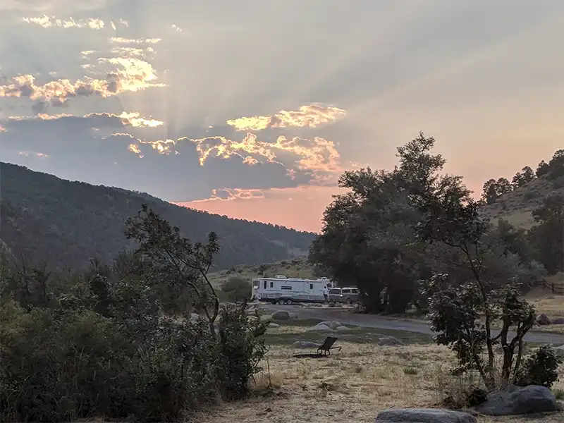
Camping at Big Creek Campground

Surrounded by water birch, cottonwood, and Russian olive trees, Big Creek Campground is situated at the mouth of a canyon along Big Creek. A lot of deer pass through here to access the creek. There is trout in the creek.

To reach the campground, take US-50 west from Austin, NV about one mile. You will see a green sign for Big Creek Campground, then head south on Big Creek Rd. Continue south for 12.3 miles to the campground.

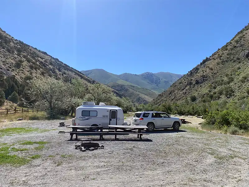
Road conditions to the campground starts out paved for the first few miles and then becomes hard-packed gravel for the rest of the way. It remains mostly smooth, and suitable for any vehicle. Once you get to the campground, the road beyond that becomes increasingly rocky as it rises elevation.

Other Campsites Within 20 Miles Radius

Associated Documents

Motor Vehicle Use Map, Page 1, Overview, Austin-Tonopah Ranger District, Humboldt-Toiyabe National Forest, 2024
Motor Vehicle Use Map, Page 2, Northwest, Austin-Tonopah Ranger District, Humboldt-Toiyabe National Forest, 2024
Motor Vehicle Use Map, Page 3, Northeast, Austin-Tonopah Ranger District, Humboldt-Toiyabe National Forest, 2024
Motor Vehicle Use Map, Page 4, Southwest, Austin-Tonopah Ranger District, Humboldt-Toiyabe National Forest, 2024
Motor Vehicle Use Map, Page 5, South & Southeast, Austin-Tonopah Ranger District, Humboldt-Toiyabe National Forest, 2024
Motor Vehicle Use Map, Page 6, Southwest, Jefferson Detail, Austin-Tonopah Ranger District, Humboldt-Toiyabe National Forest, 2024

Leave a Comment