Pine Creek Campground, Tonopah, NV

Austin-Tonopah Ranger District

Humboldt-Toiyabe National Forest

Free Camping Near Tonopah, NV

Pine Creek Campground is a free, developed campground offered by Humboldt-Toiyabe National Forest. There are 21 campsites, including a group campsite. Many of the sites are small, but there are a fair number that can accommodate RVs from 20 to 35 feet in length.

Authority

Austin-Tonopah Ranger District logo

Austin-Tonopah Ranger District

Humboldt-Toiyabe National Forest

District Office

Tel: (775) 482-6286

Official campground webpage

Particulars

GPS: 38.7962, -116.8479

Elevation: 7,454 feet

Reservations: First come, first served

Camping Fee: None

Permit: None

Max stay: 14 days

Amenities: Picnic tables, fire rings, vault toilets

Submitted by

Admin Staff

Admin Staff

Boondocker's Bible

blm map overlay BLM  national forest overlay USFS  national park map overlay NPS  national wildlife refuge map overlay NWR  city boundary map overlay City  private property map overlay Private  wilderness area overlay Wilderness [CTRL + Left Mouse Click] for 3D Tilt

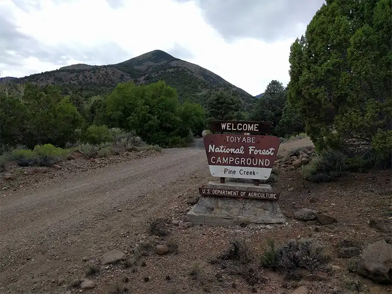
Camping at Pine Creek Campground

Situated on the eastern side of the Toquima Mountain Range in the Monitor Valley, Pine Creek Campground is known for its fishing in Peavine Creek. It offers two trailheads with access to Arc Dome Wilderness at the end of Forest Road 020.

The town of Tonopah is located 66 miles to the south, while the town of Austin is 80 miles to the north. The campground is far enough away from civilized amenities that it becomes a great place to get away from others.

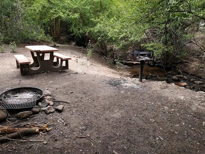
Pine Creek Campground are surrounded by Birch and Aspens, with Pine Creek itself trickling water through the campground year around.

Access into Pine Creek Campground is along State Route 82 (which itself is a dirt road), and then along Pine Creek Campground Road. The road is hard-packed gravel, suitable for any 2WD vehicle, though bumpy in places, and there are dips where the back of your trailer may scrape if you don’t have enough ground clearance.

Other Campsites Within 20 Miles Radius

Associated Documents

Motor Vehicle Use Map, Page 1, Overview, Austin-Tonopah Ranger District, Humboldt-Toiyabe National Forest, 2024
Motor Vehicle Use Map, Page 2, Northwest, Austin-Tonopah Ranger District, Humboldt-Toiyabe National Forest, 2024
Motor Vehicle Use Map, Page 3, Northeast, Austin-Tonopah Ranger District, Humboldt-Toiyabe National Forest, 2024
Motor Vehicle Use Map, Page 4, Southwest, Austin-Tonopah Ranger District, Humboldt-Toiyabe National Forest, 2024
Motor Vehicle Use Map, Page 5, South & Southeast, Austin-Tonopah Ranger District, Humboldt-Toiyabe National Forest, 2024
Motor Vehicle Use Map, Page 6, Southwest, Jefferson Detail, Austin-Tonopah Ranger District, Humboldt-Toiyabe National Forest, 2024

Leave a Comment